 Robert Culliford was born in about 1666 in East Looe, Cornwall. He was sometimes referred to as Collover. In his early career he was an associate of the later infamous William Kidd, serving with him aboard the French privateer Sainte Rose in 1689. When the Nine Years’ War broke out in 1688, they both, together with the six only other British seamen aboard, mutinied and seized a the ship as a prize from its captain, Jean Fantin. They renamed it Blessed William. In February 1690, Culliford led a mutiny against Kidd, abandoning him and electing William Mason as captain. They then roamed the Caribbean taking prizes, eventually heading to New York to sell their ill-gotten gains. Mason was granted a commission by Jacob Leisler, acting governor of New York and leader of Leisler’s Rebellion, and Culliford accompanied him when they raided two French Canadian towns and captured the French frigate L’Esperance.…
Author: savage
Laurens de Graaf
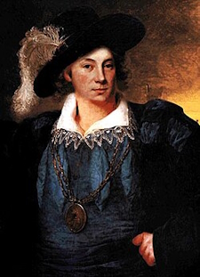 De Graaf’s full name was Laurens Cornelis Boudewijn de Graaf. He was known as ‘El Griffe’ by the Spanish, Laurent de Graff by the French, and Gesel van de West by the Dutch, the latter meaning “Scourge of the West”. He was born in about 1653 and is described as being dashing in appearance; a tall, handsome fellow with blond hair and a moustache. He apparently deplored unnecessary violence and was known to reward loyalty generously, but also to enforce discipline ruthlessly at times. He probably grew up in Rotterdam, where he acquired the necessary nautical skills for his future career. It is thought he was captured by the Spanish, possibly after involvement in a raid on Campeche in 1672, and sent to work on a plantation as a slave to the Canary Islands. He either escaped or was freed sometime around 1675. He married Petronilla de Guzmán some time before 1674 before leaving the Canary Islands for the Caribbean.…
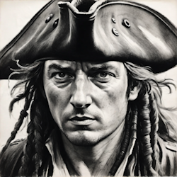
Bartholomew Sharp
 Bartholomew Sharp took on the role of buccaneer, privateer, and pirate at different times in his sea-faring career. Little is known about his early life, except that he was born in 1650 in the parish of Stepney in London. He first went to sea at a young age serving as a privateer during the second Anglo-Dutch war of 1665-67. He is thought to have served under Henry Morgan in the Caribbean, possibly during the infamous Panama raid in 1671. When peace was signed between England and Spain in the Treaty of Madrid in 1670, he became a privateer against the Dutch during the Third Anglo-Dutch war of 1672-74, obtaining the command of his own vessel in the Caribbean while fighting against the Dutch in the Leeward Islands. Once peace had been signed with the Dutch he and his men illegally turned their attention to the Spanish colonies, attacking Segovia in 1675 and capturing of Santa Marta in 1677, as well as later seizing a Spanish merchant ship in the Bay of Honduras.…
Coins of the Spanish Empire
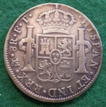 Spanish dollar – This coin, also known as the piece of eight, was made of silver and was in use from 1497 to 1864. It was also known as the real de ocho, being worth eight reals. It was one of the purest coins, slightly lighter than a British crown. It was traded at four and half shillings in England and five shillings in the American colonies. Because of the lack of small coinage in the colonies, it was often divided up into eight pieces, the reason for its popular name. The Spanish dollar was widely used as the first international currency because of its uniformity in standard and milling characteristics. They often originated from the Spanish colonies, where the milling technology not available. Although containing the same value in silver, not being milled and being more crudely minted made them easier to clip.
Howell Davis
 Howell Davis was born in 1690 in Milford Haven, Pembrokeshire in Wales. His name was sometimes spelled Hywel Davies. It is said that he grew up around the sea and was a more than competent sailor. Never his plan to become a pirate, his short pirating career lasted from July 1718 to June 1719, during which time he captured fifteen ships. According to the account written by Captain William Snelgrave some years later in 1734, Davis was not a cruel man. He wrote that Davis intervened to save him from being abused by the men of pirate captain Thomas Cocklyn, who had captured Snelgrave and his ship.